Cartography
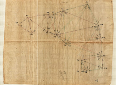
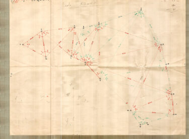
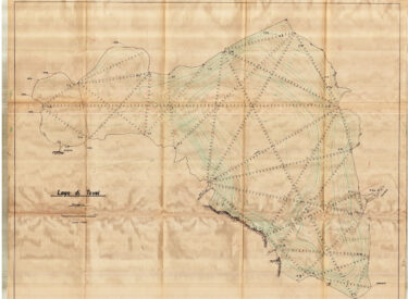
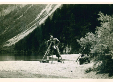
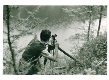
The cartographic material represents a typology of documents particularly important for limnological research. Following the work to locate the fixed buoys of the floating thermometric stations and especially the work conducted for the survey of the emerged and submerged coastal morphology of the lake, the scholars immediately noticed that the cartographic representation of the Tovel basin at their disposal was imprecise and not suitable. In light of the situation a surveyor was immediately called by the Director of the Museum, he proceeded to do a regular survey with theodolite.
In his Ricerche idrobiologiche sul Lago di Tovel Baldi wrote:
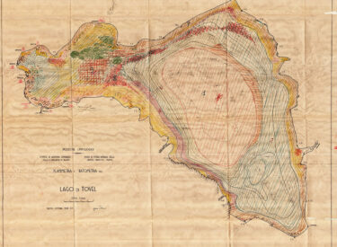
“[…] la cartografia ufficiale italiana riproduce il lago nelle due già citate tavolette della Carta d’Italia dell’Istituto Geografico Militare; le fonti di queste tavolette sono nelle levate austriache al 25.000 del 1907 e 1908; la plastica fu ridisegnata e aggiornata nel 1925 con ulteriori aggiornamenti del 1931. Con tutto questo, il miglioramento delle pessime carte austriache è modesto: il Lago di Tovel vi è presentato in un modo grossolanamente impreciso”; ancora Baldi “[…] in complesso, quindi, la cartografia precedente non è utilizzabile ai fini della ricerca limnologica. Ci siamo quindi trovati nella necessità di provvedere a rifare ex novo una levata topografica del lago.”
Documents listed in the section below concern the preparatory studies that led to the production of the cartography of Lake Tovel:
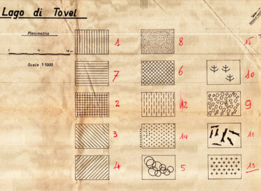
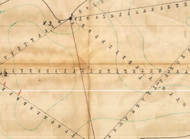
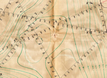
Topographical survey books, bathymetric survey and calculations of the polygon triangulation (lake contour), 3 maps at a scale of 1:1000, tables of graph paper with the following representations: profiles of the valley of Lake Tovel; the hypsographic curves of the catchment area of the lake; the curves of the volumes of the lake; the profiles of the lake; hand notes containing the bathymetric survey data of Lake Tovel carried out on the 26-27 August 1937 (by the surveyor Vittorio Conci).
The work was completed in August 1937 and checked again in May 1938, before the chart of goniometric values. The result of these surveys led to the creation of a new map including the lake with its exact topographical features. Following some maps of preparatory studies.
See documents:
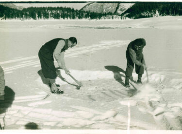
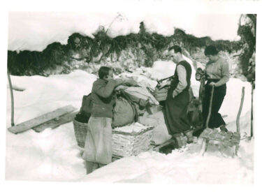
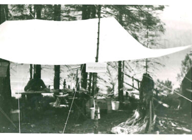
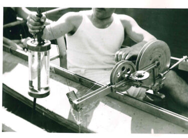
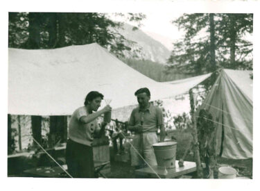
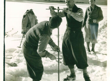
Photographic material of the study campaigns at Lake Tovel
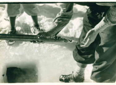
A large number of photographs document the study campaigns. Subjects of the photos are: the departure from Tuenno, the small scientific village, the samples and animal and plant species studied and the scientists.
The photos were taken in 1938-40.
For some of them, it was possible to have a more precise date.
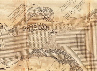
Study of the 100 stations of the coast survey of Lake Tovel
To better understand the precise work that was created by the scientists, the study concerning the 100 stations of the coastal survey of Lake Tovel is proposed below.
In the following pages – the stations, with detailed descriptions of the morphology and flora of the coasts of the basin are presented.
See document